Regents Earth Science Page
John Dewey High School
Cycle IV Homework Schedule
Cycle III Homework Schedule
Cycle II Homework Schedule
Cycle I Homework Schedule
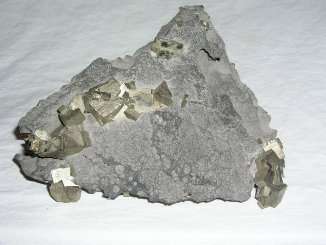
Pyrite Crystals in Limestone
Syracuse
NEW YORK
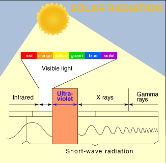
Reading the Earth Science Reference Tables Exercise and Exam Series
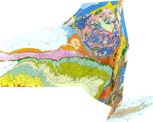
Geologic Map
of
New York State
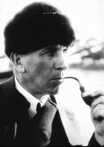
Alfred Wegener
Proponent of Continental Drift
Photographed by Michael P. Klimetz
This page was last updated on: August 25, 2023
Pyrite Crystals in Dolostone
Syracuse, NY
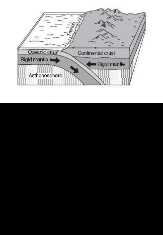
Convergent Plate Margin
Oceanic Lithosphere Subducted Beneath Contnental Lithosphere
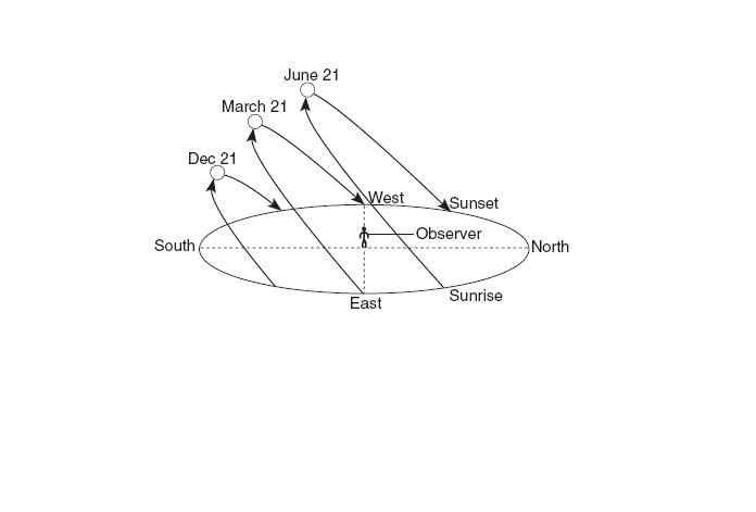
Apparent Motion of the Sun
Sun's Apparent Motion from the Winter Solstice to the Summer Solstice to an Observer in New York State
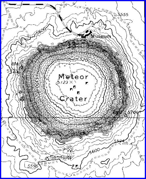
Contour Map of an Impact Crater
Topographic Contour Map of the Barringer Impact Crater near Winslow, Arizona
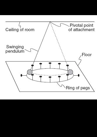
Foucault Pendulum
Sketch of Device Which Demonstrates Earth's Rotation
All Pegs in the Ring Rotate with the Earth and are Struck Down
Graded Bedding
Vertical Arrangement of Sedimentary Particles Based on Size When Mixed-Size Sediments are Deposited Simultaneously in Water
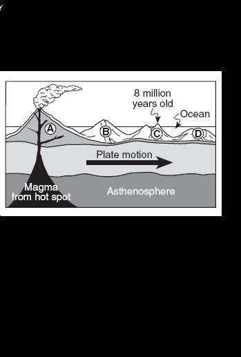
Hot Spot
Cartoon of a Hotspot Located Beneath Oceanic Lithosphere
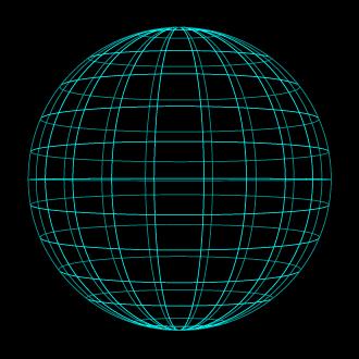
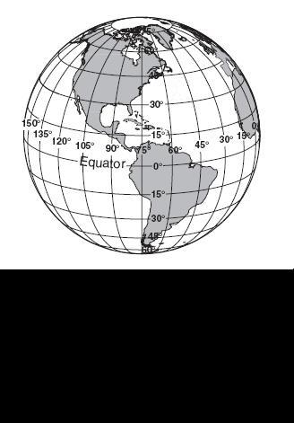
Latitude and Longitude
Shown at 15 degree Intervals
Sling Psychrometer
Device Used to Determine Dewpoint Temperature and Relative Humidity
Transform Plate Margin
Boundary Between the Pacific and North American Plates at the San Andreas Fault
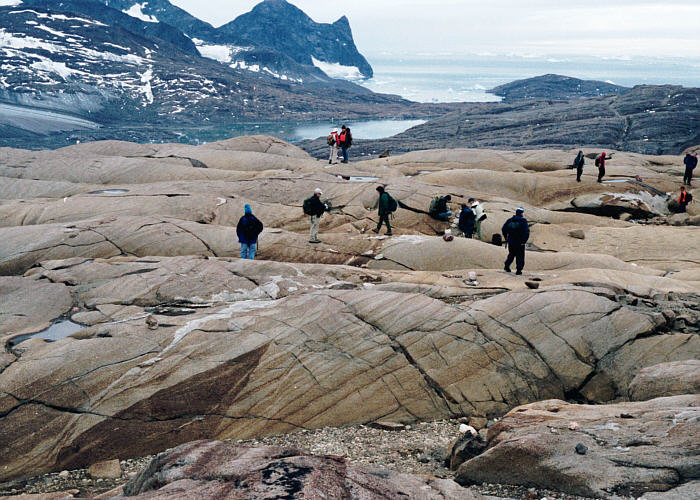
Glacially Scoured and Eroded Rock Surface
Greenland
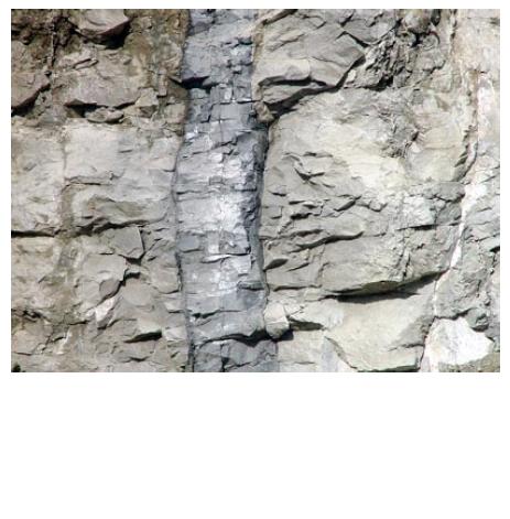
Overturned, Reverse-Faulted, and Contact-Metamorphosed Strata
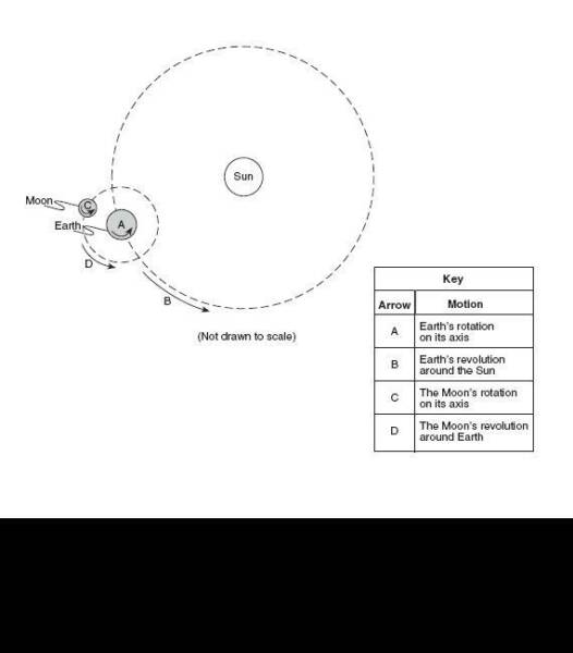
Sun-Earth-Moon Orbital System
Dike
Mafic Dike Intruding Light-Colored Country Rock
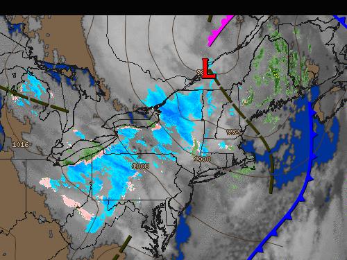
Surface Analysis Weather Map
(Thursday, October 16, 2008 at 2:00 pm)
Surface Analysis Weather Map
(Wednesday, October 29, 2008 at 2:00 am)
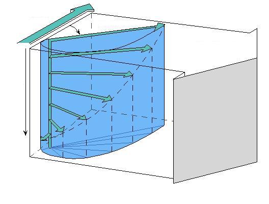
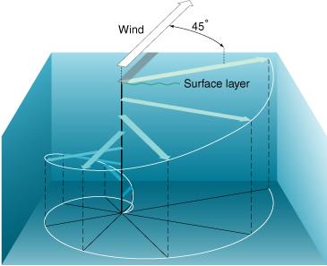
Lake Effect Snow and Circulation Around a Low Pressure System
Double Rainbow
Brooklyn, NY
(Saturday, June 27, 2009 at 4:00 pm)
Water Displacement Vector
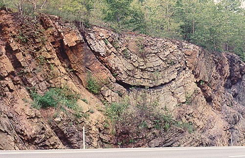
Tremont Syncline
Llewellyn Formation - Pennsylvanian
I-81
Schuylkill County
PENNSYLVANIA
[Photograph Courtesy of the Pennsylvania Geological Survey]
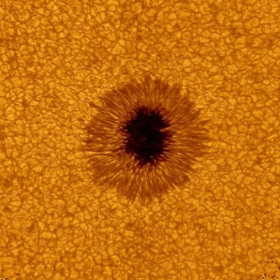
Sunspot
[Photograph Courtesy of NASA]
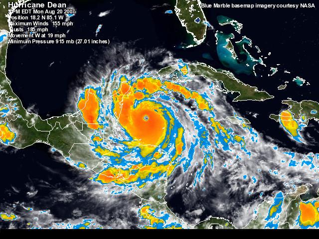
Hurricane Earl
As Viewed from the International Space Station
[August, 2010]
[Photograph Courtesy of NASA]
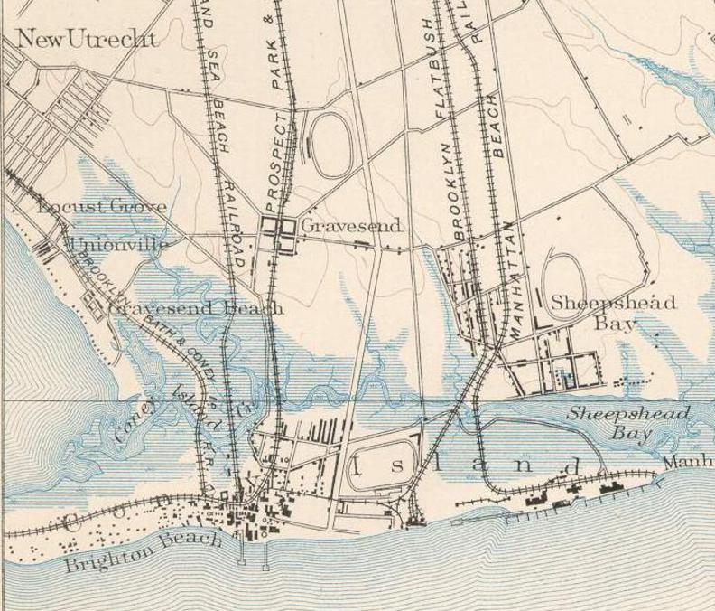
1889 Topographic Map of Southwestern Brooklyn
Future Location of John Dewey High School
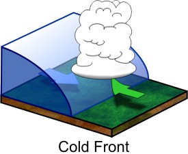
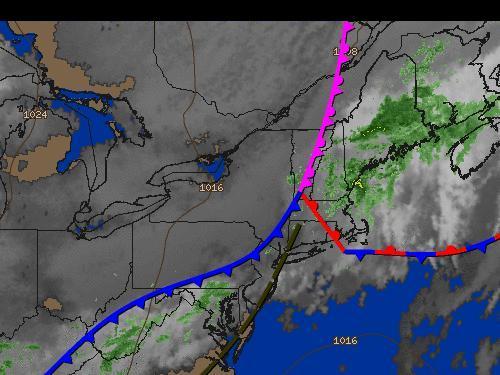
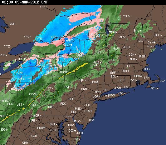
Radar Signature of a Cold Front
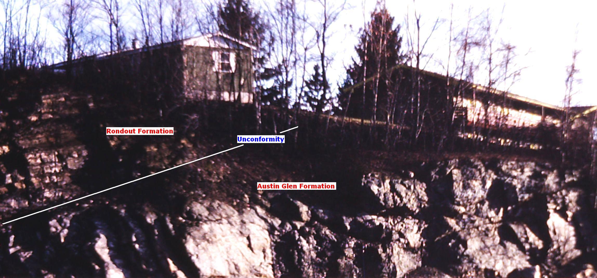
Taconic Unconformity
New York State Thruway Interchange 23
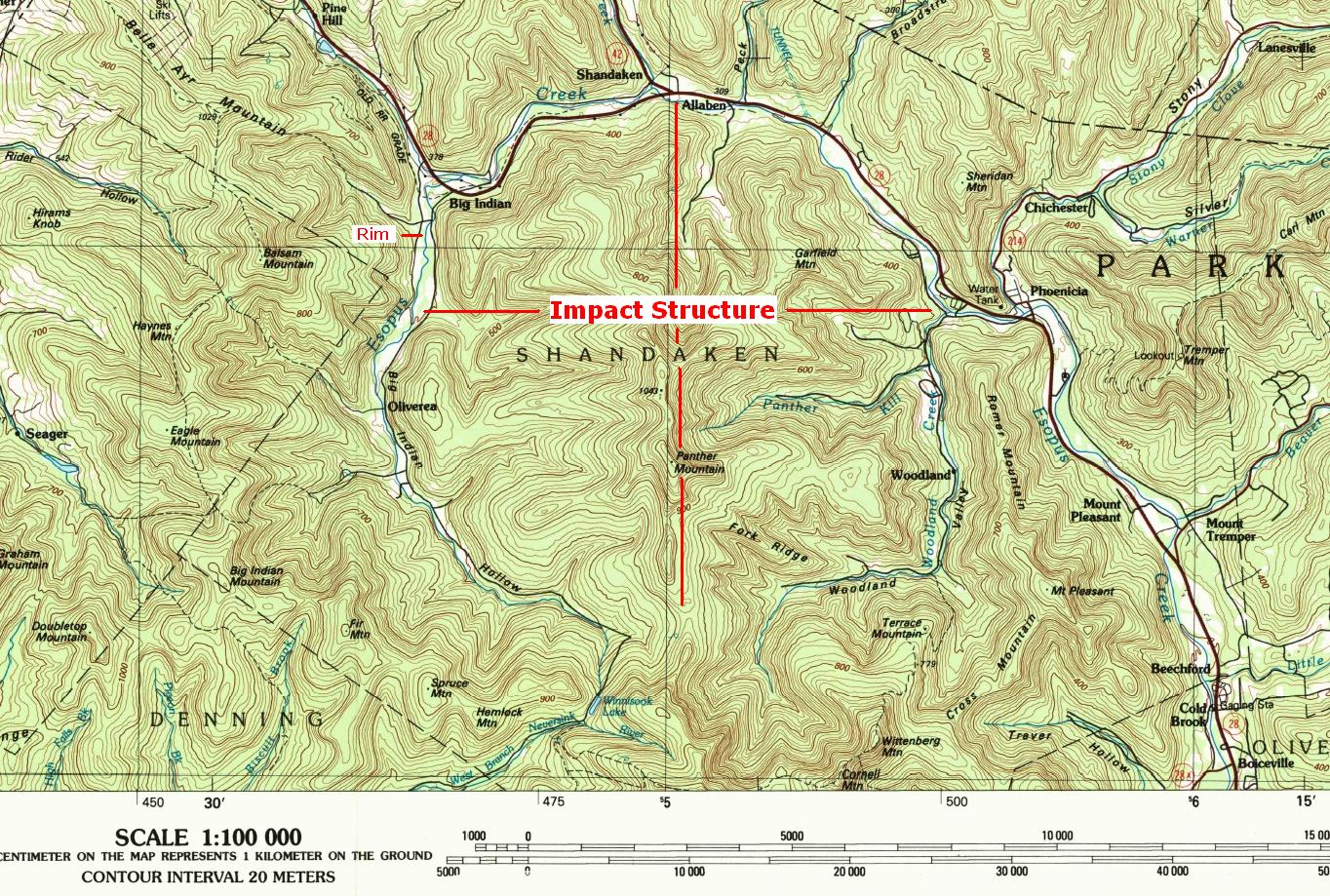
Panther Mountain Impact Structure
Shandaken, NY
[Topographic Map]
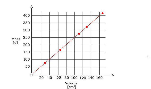
Mass vs. Volume Graph
Five Bodies of Different Mass and Volume
Each Comprised of a Material with a Density of 2.5 grams per cubic centimeter
[Slope = Density]
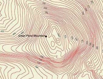
Great Pond Mountain
Topographic Map
[Contour Interval: 25 Feet]
Double click here to add text.
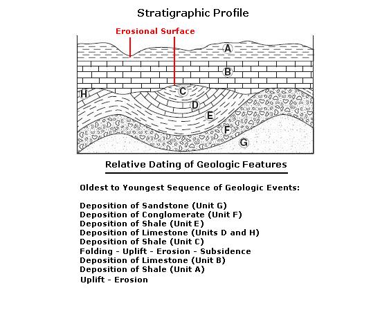
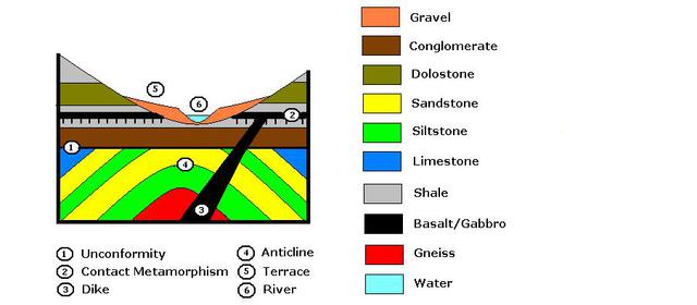
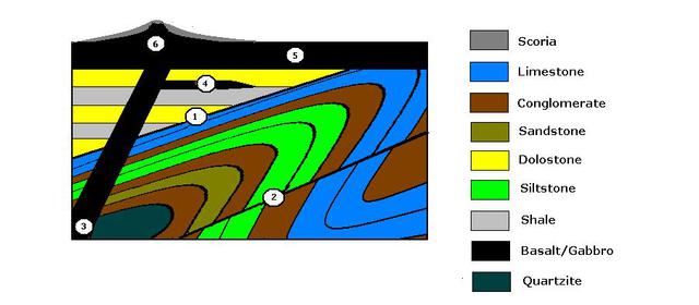
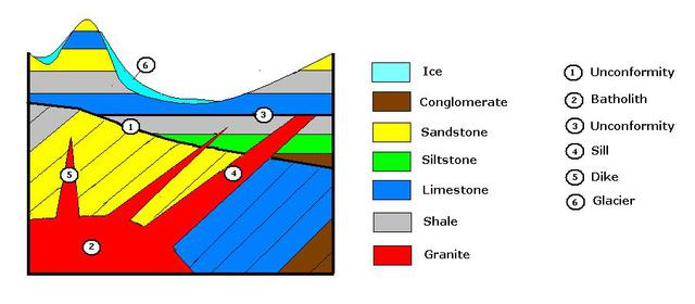
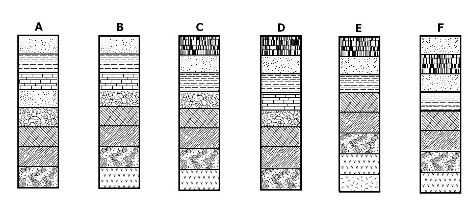
Stratigraphic Correlation
Rainbow
Gerritsen Avenue
Brooklyn, NY
(Friday, July 1, 2016 at 3:00 pm)
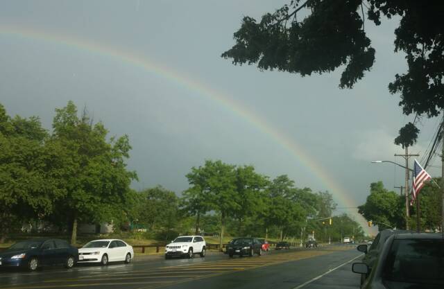
Rainbow
Gerritsen Avenue
Brooklyn, NY
(Friday, July 1, 2016 at 3:00 pm)
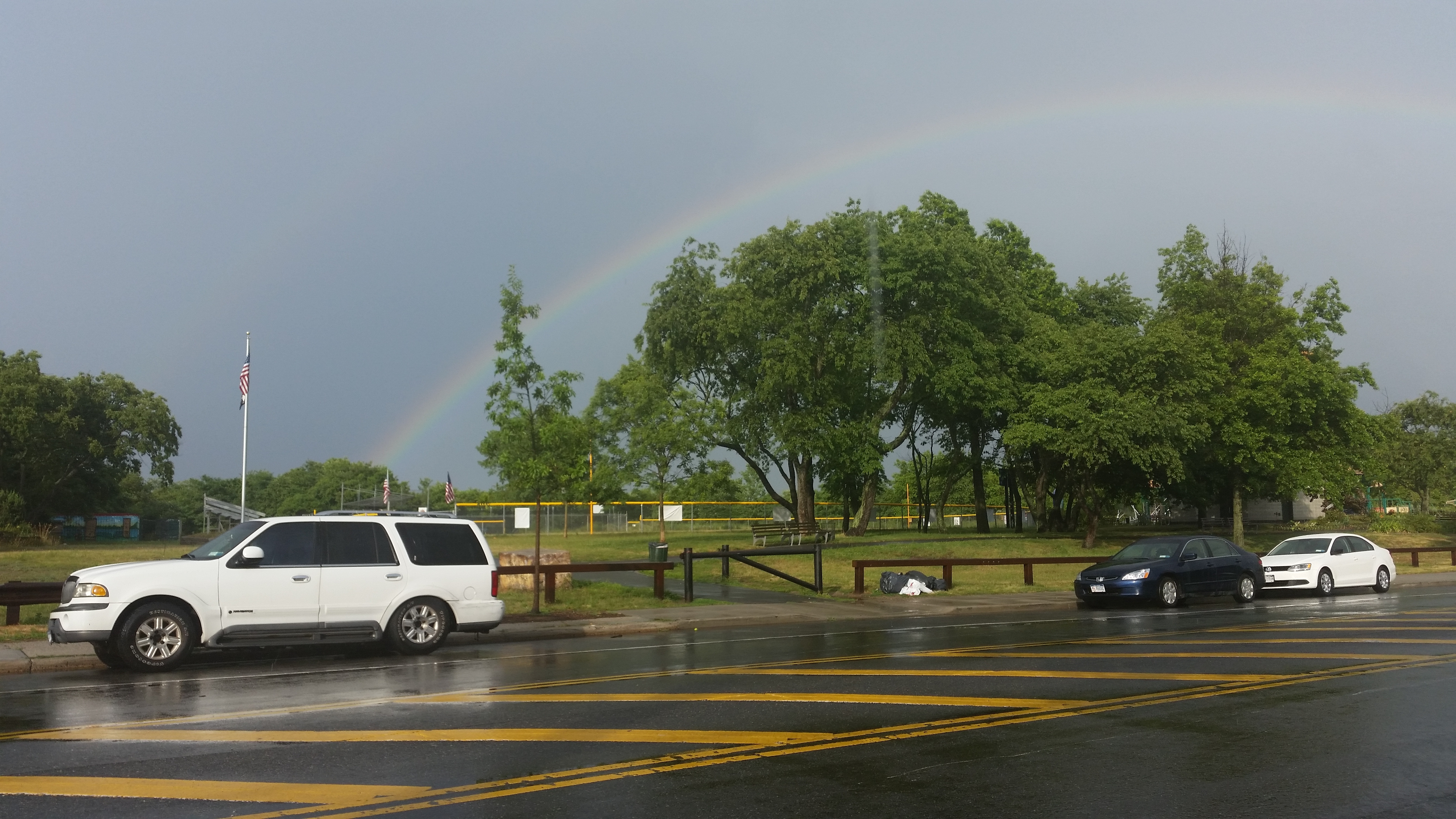
Rainbow
Gerritsen Avenue
Brooklyn, NY
(Friday, July 1, 2016 at 3:00 pm)
Rainbow
Gerritsen Avenue
Brooklyn, NY
(Friday, July 1, 2016 at 3:00 pm)
Rainbow
Gerritsen Avenue
Brooklyn, NY
(Friday, July 1, 2016 at 3:00 pm)